Bethel (Connecticut)
| Dieser Artikel wurde aufgrund von inhaltlichen Mängeln auf der Qualitätssicherungsseite des Projektes USA eingetragen. Hilf mit, die Qualität dieses Artikels auf ein akzeptables Niveau zu bringen, und beteilige dich an der Diskussion! Eine nähere Beschreibung der zu behebenden Mängel fehlt. |  |
| Bethel | |||
|---|---|---|---|
 Town Hall (Rathaus) | |||
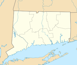
| Lage in Connecticut | |||
| |||
| Basisdaten | |||
| Gründung: | 1855 | ||
| Staat: | Vereinigte Staaten | ||
| Bundesstaat: | Connecticut | ||
| County: | Fairfield County | ||
| Koordinaten: | 41° 22′ N, 73° 24′ W41.373611111111-73.407222222222147Koordinaten: 41° 22′ N, 73° 24′ W | ||
| Zeitzone: | Eastern (UTC−5/−4) | ||
| Einwohner: – Metropolregion: | 20.358 (Stand: 2020) 20.140.470 (Stand: 2020) | ||
| Haushalte: | 7.233 (Stand: 2020) | ||
| Fläche: | 43,8 km² (ca. 17 mi²) davon 43,5 km² (ca. 17 mi²) Land | ||
| Bevölkerungsdichte: | 468 Einwohner je km² | ||
| Höhe: | 147 m | ||
| Postleitzahl: | 06801 | ||
| Vorwahl: | +1 203 | ||
| FIPS: | 09-04720 | ||
| GNIS-ID: | 0213390 | ||
| Website: | www.bethelct.org | ||

Bethel (ˈbɛθəl) ist eine Gemeinde im Fairfield County im US-Bundesstaat Connecticut. Das U.S. Census Bureau hat bei der Volkszählung 2020 eine Einwohnerzahl von 20.358[1] ermittelt.
Geschichte
Bevölkerungsentwicklung
|
|
|
Wirtschaft und Infrastruktur
Der Fahrradhersteller Cannondale und der Batteriehersteller Duracell haben beide ihren Sitz in dieser Stadt.
Persönlichkeiten
- P. T. Barnum (1810–1891), Zirkuspionier
- Orris S. Ferry (1823–1875), Politiker
- Julius Hawley Seelye (1824–1895), Autor, Politiker
- Thomas J. Craughwell (1956–2018), Autor
Weblinks
Commons: Bethel (Connecticut) – Sammlung von Bildern, Videos und Audiodateien
Einzelnachweise
- ↑ Explore Census Data Bethel town, Fairfield County, Connecticut. Abgerufen am 11. November 2022.
County Seat: Bridgeport
| Cities | Bridgeport • Danbury • Norwalk • Shelton • Stamford | |
| Towns | Bethel • Brookfield • Darien • Easton • Fairfield • Greenwich • Monroe • New Canaan • New Fairfield • Newtown • Redding • Ridgefield • Sherman • Stratford • Trumbull • Weston • Westport • Wilton | |
| CDPs | Ball Pond • Bethel • Bigelow Corners • Bogus Hill • Botsford • Branchville • Brookfield Center • Byram • Candlewood Isle • Candlewood Knolls • Candlewood Lake Club • ‡ Candlewood Orchards • Candlewood Shores • Cannondale • Coleytown • Compo • Cos Cob • Daniels Farm • Darien Downtown • Dodgingtown • East Village • Fairfield University • Georgetown • Glenville • Greens Farms • Greenwich • Hawleyville • Indian Field • Inglenook • Kellogg Point • Knollcrest • Lakes East • Lakes West • Lakeside Woods • Long Hill • Lordship • Mamanasco Lake • Mill Plain • Murray • New Canaan • Noroton • Noroton Heights • Old Greenwich • Old Hill • Oronoque • Pemberwick • Plattsville • Poplar Plains • Redding Center • Ridgebury • Ridgefield • Riverside • Rock Ridge • Route 7 Gateway • Sacred Heart University • Sail Harbor • Sandy Hook • Saugatuck • Sherman • South Wilton • Southport • Staples • Stepney • Stratford Downtown • Tashua • Taylor Corners • Tokeneke • Topstone • Trumbull Center • West Mountain • Weston • Westport Village • Wilton Center | |
| Unincorporated Communities | Aspetuck • Greenfield Hill • Hattertown • Mianus • Mill Plain • Nichols • Silvermine | |
| Borough | Newtown | |
| Geisterstadt | Little Danbury |


