Big Stone Gap East, Virginia
Census-designated place in Virginia, United States
36°52′56″N 82°44′36″W / 36.88222°N 82.74333°W / 36.88222; -82.74333 (2020)[2]
24219 (Big Stone Gap)
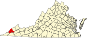
Big Stone Gap East is an unincorporated area and census-designated place (CDP) in Wise County, Virginia, United States. It was first listed as a CDP in the 2020 census with a population of 687.[4][2]
The CDP is in the southwest part of the county, on the east edge of the town of Big Stone Gap, outside the town limits. U.S. Route 23 and 58 Alternate, a four-lane expressway, curves to the south and east of the community, separating it from East Stone Gap to the south. Norton is 8 miles (13 km) to the northeast.
References
- ^ "2020 U.S. Gazetteer Files – Virginia". United States Census Bureau. Retrieved October 25, 2021.
- ^ a b "Big Stone Gap East CDP, Virginia: 2020 DEC Redistricting Data (PL 94-171)". U.S. Census Bureau. Retrieved October 25, 2021.
- ^ "Big Stone Gap East Census Designated Place". Geographic Names Information System. United States Geological Survey, United States Department of the Interior.
- ^ "Big Stone Gap East CDP, Virginia". United States Census Bureau. Retrieved April 7, 2022.
- v
- t
- e
Municipalities and communities of Wise County, Virginia, United States
County seat: Wise
communities
‡This populated place also has portions in an adjacent county or counties
- Virginia portal
- United States portal
 | This Wise County, Virginia state location article is a stub. You can help Wikipedia by expanding it. |
- v
- t
- e


