Deest
Village in Gelderland, Netherlands
51°53′N 5°40′E / 51.883°N 5.667°E / 51.883; 5.667 (2021)[1]
6653[1]
Deest is a village in the Dutch province of Gelderland. It is a part of the municipality of Druten, and lies about 9 km south of Wageningen.
History
It was first mentioned in 814 as T(h)esta (CL I, no. 101) and 997 as Dheste. The etymology in unknown.[3] In 1840, it was home to 451 people.[4] Deest became an independent parish in 1858 when the first church was built.[4] In 1919, the brickworks Vogelensangh opened, and is still in operation.[4]
On 3 February 1945, the monastery was hit by a V-1 flying bomb killing seven sisters, two women and two children. On 8 February, another V1 hit the village killing 10 people. Most of the centre was destroyed. In 1953, the church was rebuilt.[5]
Gallery
-
 Barn in Deest
 -
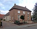 House in Deest
 -
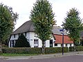 Farm in Deest
 -
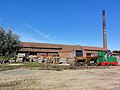 Brickworks


References
- ^ a b c "Kerncijfers wijken en buurten 2021". Central Bureau of Statistics. Retrieved 21 March 2022.
- ^ "Postcodetool for 6653AA". Actueel Hoogtebestand Nederland (in Dutch). Het Waterschapshuis. Retrieved 21 March 2022.
- ^ "Deest - (geografische naam)". Etymologiebank (in Dutch). Retrieved 21 March 2022.
- ^ a b c "Deest". Plaatsengids (in Dutch). Retrieved 21 March 2022.
- ^ "In februari 1945 verloor Deest haar hart". Mijn Gelderland (in Dutch). Retrieved 21 March 2022.
| Authority control databases: Geographic |
|
|---|
 | This Gelderland location article is a stub. You can help Wikipedia by expanding it. |
- v
- t
- e


