Ennigerloh
Town in North Rhine-Westphalia, Germany

Coat of arms
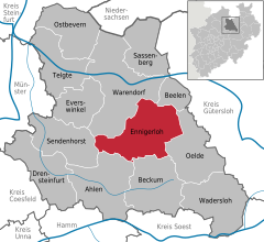
Location of Ennigerloh within Warendorf district
(2022-12-31)[2]
59320
02528 (Enniger)
02587 (Westkirchen)
Ennigerloh (German pronunciation: [ˈɛnɪɡɐˌloː] ⓘ) is a town in the district of Warendorf, in North Rhine-Westphalia, Germany. It is situated approximately 25 km northeast of Hamm and 30 km southeast of Münster.
The town, located in an agricultural area and with a well-preserved medieval quarter, became more industrial in the 20th century as several cement factories were installed. Some of these closed towards the end of the century. Furniture manufacturing was also a significant industry.
Geography
Subdivisions
- Enniger
- Westkirchen
- Ostenfelde
- Hoest
Notable people
- Alois Hanslian (born 1943), painter
- Willy Hartner (1905–1981), professor, founded the Institute for the History of Natural Sciences in Frankfurt am Main
- Karl Weierstrass (1815–1897), mathematician often described as "the father of analysis"
References
- ^ Wahlergebnisse in NRW Kommunalwahlen 2020, Land Nordrhein-Westfalen, accessed 30 June 2021.
- ^ "Bevölkerung der Gemeinden Nordrhein-Westfalens am 31. Dezember 2022 – Fortschreibung des Bevölkerungsstandes auf Basis des Zensus vom 9. Mai 2011" (in German). Landesbetrieb Information und Technik NRW. Retrieved 20 June 2023.
External links
- Official website
 (in German)
- v
- t
- e
Towns and municipalities in Warendorf (district)
- Ahlen
- Beckum
- Beelen
- Drensteinfurt
- Ennigerloh
- Everswinkel
- Oelde
- Ostbevern
- Sassenberg
- Sendenhorst
- Telgte
- Wadersloh
- Warendorf

Authority control databases | |
|---|---|
| International |
|
| National |
|
| Geographic |
|
| This Warendorf district location article is a stub. You can help Wikipedia by expanding it. |
- v
- t
- e


