Fentons Creek, Victoria
Town in Victoria, Australia
36°33′33″S 143°32′21″E / 36.55917°S 143.53917°E / -36.55917; 143.53917- 235 km (146 mi) NW of Melbourne
- 90 km (56 mi) W of Bendigo
- 19 km (12 mi) S of Wedderburn
Fentons Creek is a locality in Victoria, Australia. It is located near Wedderburn in the Loddon Shire. A creek with the same name runs along the edge of the township. At the 2006 census, the suburb had a population of 115.[1]

The town covers a large area. At a central spot there is a Country Fire Authority station/shed, a chapel and an old schoolhouse that is no longer used.
Gallery
-
 The chapel
 -
 The old schoolhouse
 -
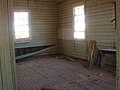 Inside the schoolhouse


References
Wikimedia Commons has media related to Fentons Creek, Victoria.
- ^ a b Australian Bureau of Statistics (25 October 2007). "Fentons Creek (State Suburb)". 2006 Census QuickStats. Retrieved 27 January 2009.
- v
- t
- e
Localities in the Shire of Loddon

- Appin South^
- Arnold
- Arnold West
- Auchmore
- Barraport
- Barraport West
- Bears Lagoon
- Berrimal
- Borung
- Brenanah
- Bridgewater North
- Buckrabanyule^
- Burkes Flat
- Calivil
- Campbells Forest
- Canary Island
- Catumnal
- Cochranes Creek
- Derby
- Durham Ox
- Eastville^
- Eddington^
- Emu^
- Fentons Creek
- Fernihurst
- Fiery Flat
- Gladfield
- Glenalbyn
- Glenloth East^
- Goldsborough^
- Gowar East^
- Gredgwin^
- Horfield^
- Inkerman^
- Jarklin
- Jungaburra
- Kamarooka^
- Kamarooka North
- Kingower
- Kinypanial
- Kurraca
- Kurraca West
- Kurting
- Laanecoorie
- Lake Marmal^
- Lake Meran^
- Leaghur
- Leichardt^
- Llanelly
- Loddon Vale
- Logan^
- Macorna^
- McIntyre
- Meering West^
- Milloo^
- Mincha
- Minmindie
- Moliagul^
- Mologa
- Murphys Creek
- Mysia
- Nine Mile^
- Painswick
- Pompapiel
- Powlett Plains
- Prairie
- Rheola
- Richmond Plains^
- Salisbury West
- Shelbourne^
- Skinners Flat
- Slaty Creek^
- Sylvaterre
- Tandarra
- Terrappee^
- Terrick Terrick
- Waanyarra
- Wedderburn Junction
- Wehla
- Woodstock On Loddon
- Woodstock West
- Woolshed Flat
- Woosang^
- Wychitella
- Wychitella North
- Yando
- Yarraberb
- Yarrawalla
- Yeungroon East^
^ - Territory divided with another LGA
 | This article about a location in the Mallee is a stub. You can help Wikipedia by expanding it. |
- v
- t
- e


