Jrarat, Kotayk
40°33′12″N 44°45′27″E / 40.55333°N 44.75750°E / 40.55333; 44.75750
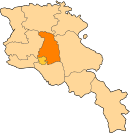
Place in Kotayk, Armenia
Jrarat Ջրառատ | |
|---|---|
 Skyline of Jrarat | |
  Jrarat | |
| Coordinates: 40°33′12″N 44°45′27″E / 40.55333°N 44.75750°E / 40.55333; 44.75750 | |
| Country |  Armenia Armenia |
| Province | Kotayk |
| Founded | 1982 |
| Population (2011)[1] | |
| • Total | 521 |
| Time zone | UTC+4 (AMT) |
| Jrarat, Kotayk at GEOnet Names Server | |
Jrarat (Armenian: Ջրառատ) is a village in the Kotayk Province of Armenia. It was incorporated in 1982 and is the center of the dairy industry.[2]
Toponymy
The village was previously known as Randamal.
References
- ^ Statistical Committee of Armenia. "The results of the 2011 Population Census of Armenia" (PDF).
- ^ Kiesling, Rediscovering Armenia, p. 56, available online at the US embassy to Armenia's website Archived 2008-06-26 at the Wayback Machine
External links
Wikimedia Commons has media related to Jrarat.
- Report of the results of the 2001 Armenian Census, Statistical Committee of Armenia
- v
- t
- e
Kotayk ProvinceCapital: Hrazdan
- Abovyan
- Byureghavan
- Charentsavan
- Hrazdan
- Nor Hachn
- Tsaghkadzor
- Yeghvard
Portal:
 Geography


