Knob Fork, West Virginia
Unincorporated community in West Virginia, United States
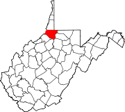
39°38′55″N 80°32′48″W / 39.64861°N 80.54667°W / 39.64861; -80.54667Knob Fork is a diffuse, unincorporated hamlet in Wetzel County, West Virginia, United States. It lies at an elevation of 1050 feet (320 m). Its only business or service is a wholesale nursery. Other names for the community have included Geaneytown, Jolliff, Jolliffe, Jolliffes Store, Knobfork Store, Sugar Run, and Uniontown.[1] The present name is derived from the nearby Knob Fork creek.[2]
References
- v
- t
- e
Municipalities and communities of Wetzel County, West Virginia, United States
County seat: New Martinsville
- Hundred
- Pine Grove
- Smithfield
communities
- Allister
- Anthem
- Archer
- Bane
- Barker
- Bebee
- Big Run
- Brink‡
- Brooklyn
- Burchfield
- Burton
- Carbide
- Childs
- Coburn
- Earnshaw
- Fairview
- Fanlight
- Far
- Folsom
- Four Mile
- Galmish
- Green Hill
- Hastings
- Hazel
- Hoyt
- King
- Knob Fork
- Kodol
- Mand
- Marion
- Maud
- Minnie
- Mobley
- Porters Falls
- Proctor
- Rockport
- Round Bottom
- Sincerity
- Van Camp
- Veto
- Vincen‡
- West
- Wheat
- Wileyville
‡This populated place also has portions in an adjacent county or counties
- West Virginia portal
- United States portal
 | This article about a location in Wetzel County, West Virginia is a stub. You can help Wikipedia by expanding it. |
- v
- t
- e


