Labuche Kang

Labuche Kang
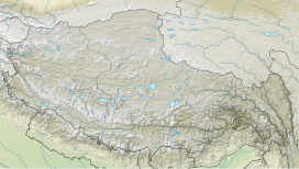
Location in Tibet, China
Labuche Kang (or Lapche Kang, Lobuche Kang I, Choksiam) is a northern outlier of the Himalayas inside Tibet. It rises northwest of Rolwaling Himal and east of Shishapangma. The peak belongs to a little-known section of the Himalaya variously called Labuche Himal, Pamari Himal and Lapchi Kang[2] that extends from the valley of the Tamakosi River west to the valley of the Sun Kosi and Nyalam Tong La pass where Arniko-Friendship Highway cross the Himalaya. This section extends south into Nepal east of Arniko Highway. It is wholly within the catchment of the Kosi, a Ganges tributary.
Labuche Kang was first climbed in 1987 by a Sino-Japanese expedition, via the West Ridge. No other attempts are recorded[3] until September 2010 when American climber Joe Puryear fell to his death during an unsuccessful attempt.[4]
See also
References
- ^ a b c "China I: Tibet - Xizang". Peaklist.org. Retrieved 2014-05-30.
- ^ Carter, H. Adams (1985). "Classification of the Himalaya" (PDF). American Alpine Journal. 27 (59). American Alpine Club: 122. Retrieved May 1, 2011.
- ^ "Himalayan Index". London: Alpine Club. Retrieved May 18, 2011.
- ^ Puryear's accident Archived 2010-10-31 at the Wayback Machine
- v
- t
- e


