Langedijk

Listen to this article (3 minutes)
This audio file was created from a revision of this article dated 18 Dec 2021, and does not reflect subsequent edits.
Problems playing this file? See media help.
Former municipality in North Holland, Netherlands

Flag

Coat of arms

Location of the former municipality of Langedijk in North Holland
(January 2021)[3]
1720–1724, 1830–1834
Langedijk (Dutch: [ˌlɑŋəˈdɛik] ⓘ; West Frisian Dutch: Langedìk) is a former municipality in the Netherlands, in the province of North Holland and the region of West-Frisia. Langedijk received city rights in 1415.
Langedijk and the former municipality of Heerhugowaard merged into the new municipality of Dijk en Waard on 1 January 2022.
Population centres
The former municipality of Langedijk consisted of the following cities, towns, villages and/or districts:
Topography
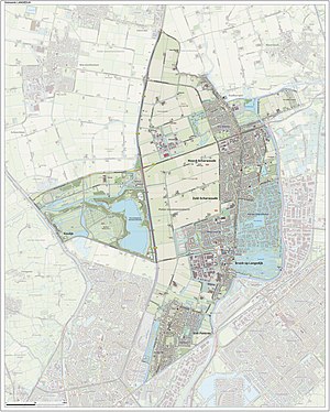
Map of the former municipality of Langedijk, 2015
Local government
The former municipal council of Langedijk consisted of 21 seats, which were divided as follows:
- Kleurrijk Langedijk (5 seats, new party)
- CDA (4 seats)
- PvdA (4 seats)
- VVD (3 seats)
- GroenLinks (2 seats)
- Hart voor Langedijk/D66 (2 seats)
- ChristenUnie (1 seats)
Notable people

- Johannes Hertenberg (1668 in Oudkarspel – 1725) the 19th Dutch Governor of Ceylon from 1723 until his death
- Theo Nieuwenhuis (1866 in Noord-Scharwoude - 1951) a Dutch watercolor painter, lithograph designer, woodcarver and ceramics and textile designer
- Berend Tobia Boeyinga (1886 in Noord-Scharwoude - 1969) a Dutch architect, noted for his Calvinist church buildings
- Laurens Bogtman (1900 in Oudkarspel – 1969) a Dutch baritone
- Hendrik Jan Marsman (1937 in Sint Pancras – 2012), pen name, J. Bernlef, a Dutch writer, poet, novelist and translator
Sport
- Jan Langedijk (1910 in Oudkarspel – 1981) a Dutch speed skater who competed at the 1936 and 1948 Winter Olympics
- Gerard Kamper (born 1950 in Koedijk) a retired Dutch cyclist
- Jan Blokhuijsen (born 1989 in Zuid-Scharwoude) Dutch long-track speed skater, silver medallist at the 2014 Winter Olympics
Gallery
-
 Broekerveiling
 -
 Noord-Scharwoude
 -
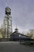 Houten zaalkerk met op de voorgrond een vrijstaande stalen klokkentoren - Koedijk
 -
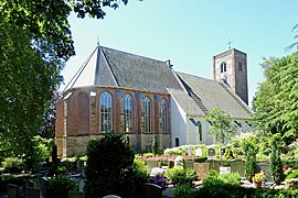 Allemanskerk1 Oudkarspel
 -
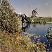 Vergezicht met molen en houten loopbrug - Sint Pancras


References
- ^ "Kerncijfers wijken en buurten 2020" [Key figures for neighbourhoods 2020]. StatLine (in Dutch). CBS. 24 July 2020. Retrieved 19 September 2020.
- ^ "Postcodetool for 1722GX". Actueel Hoogtebestand Nederland (in Dutch). Het Waterschapshuis. Archived from the original on 21 September 2013. Retrieved 13 March 2014.
- ^ "Bevolkingsontwikkeling; regio per maand" [Population growth; regions per month]. CBS Statline (in Dutch). CBS. 1 January 2021. Retrieved 2 January 2022.
External links
 Media related to Langedijk at Wikimedia Commons
- Official website
Places adjacent to Langedijk | ||||||||||||||||
|---|---|---|---|---|---|---|---|---|---|---|---|---|---|---|---|---|
| ||||||||||||||||


| Authority control databases: Geographic |
|
|---|
- v
- t
- e


