List of Pennsylvania state historical markers in Susquehanna County

This is a list of the Pennsylvania state historical markers in Susquehanna County.
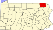
This is intended to be a complete list of the official state historical markers placed in Susquehanna County, Pennsylvania by the Pennsylvania Historical and Museum Commission (PHMC). The locations of the historical markers, as well as the latitude and longitude coordinates as provided by the PHMC's database, are included below when available. There are ten historical markers located in Susquehanna County.[1]
Map all coordinates using OpenStreetMap
Download coordinates as:
- KML
- GPX (all coordinates)
- GPX (primary coordinates)
- GPX (secondary coordinates)
Historical markers
| Marker title | Image | Date dedicated | Location | Marker type | Topics |
|---|---|---|---|---|---|
| Galusha Grow |  | May 15, 1947 | Intersection US 11 & PA 547, N of Kingsley 41°45′44″N 75°45′11″W / 41.76232°N 75.75308°W / 41.76232; -75.75308 (Galusha Grow) | Roadside | Early Settlement, Government & Politics, Government & Politics 19th Century |
| Galusha Grow | | May 15, 1947 | PA 547 at cemetery, Harford 41°46′48″N 75°42′05″W / 41.78005°N 75.70128°W / 41.78005; -75.70128 (Galusha Grow) | Roadside | Early Settlement, Government & Politics, Government & Politics 19th Century |
| Galusha Grow | | May 15, 1947 | PA 92 just N of PA 374, Glenwood 41°39′05″N 75°43′16″W / 41.65134°N 75.72123°W / 41.65134; -75.72123 (Galusha Grow) | Roadside | Early Settlement, Government & Politics, Government & Politics 19th Century |
| Jonathan Jasper Wright (1840-1885) |  | September 13, 2001 | PA 29 & Cemetery St. (T361), Springville 41°41′43″N 75°55′07″W / 41.69523°N 75.91872°W / 41.69523; -75.91872 (Jonathan Jasper Wright) | Roadside | African American, Government & Politics 19th Century, Professions & Vocations, Underground Railroad |
| Joseph Smith |  | May 15, 1947 | US 11 near I-81 interchange, between Great Bend & Hallstead 41°57′57″N 75°44′26″W / 41.96588°N 75.74065°W / 41.96588; -75.74065 (Joseph Smith) | Roadside | Religion, Writers |
| Joseph Smith |  | March 30, 1948 | PA 171 at cemetery, near Skinner Rd., W of Oakland | Roadside | Religion, Writers |
| Mother Theresa Maxis Duchemin (1810-1892) | May 6, 2009 | Turnpike St. (SR 1013) & Broad Ave., Susquehanna Depot | Roadside | African American, Religion, Women | |
| Pennsylvania |  | January 1, 2008 | Lackawanna Trail (US 11), N of Great Bend, near NY state line 42°08′51″N 75°47′58″W / 42.1475°N 75.7994°W / 42.1475; -75.7994 (Pennsylvania) | Roadside | Government & Politics 17th Century, Government & Politics 18th Century, Religion, William Penn |
| Starrucca Viaduct |  | September 1, 1951 | SR 1009 at Lanesboro near viaduct (Missing) | Roadside | Navigation, Railroads, Transportation |
| Susquehanna County | July 5, 1982 | Monument Square at Maple St. & Lake Ave., adjacent to County Courthouse, Montrose 41°50′02″N 75°52′37″W / 41.8339°N 75.87682°W / 41.8339; -75.87682 (Susquehanna County) | City | African American, Government & Politics, Government & Politics 19th Century, Underground Railroad |
See also
 Pennsylvania portal

- List of Pennsylvania state historical markers
- National Register of Historic Places listings in Susquehanna County, Pennsylvania
References
- ^ "PHMC Historical Markers Search" (Searchable database). Pennsylvania Historical and Museum Commission. Commonwealth of Pennsylvania. Retrieved 2010-07-19.
External links
- Pennsylvania Historical Marker Program
- Pennsylvania Historical & Museum Commission
- v
- t
- e
Municipalities and communities of Susquehanna County, Pennsylvania, United States
County seat: Montrose
- Forest City
- Friendsville
- Great Bend
- Hallstead
- Hop Bottom
- Lanesboro
- Little Meadows
- Montrose
- New Milford
- Oakland
- Susquehanna Depot
- Thompson
- Union Dale
- Forest Lake
- Harford
- Lakeside
- Laurel Lake
- South Montrose
- Springville
communities
- Pennsylvania portal
- United States portal


