Mazraat el Daher
City in Mount Lebanon Governorate
Mazraat el Daher Arabic: مزرعة الضهر | |
|---|---|
City | |
| 33°35′N 35°30′E / 33.583°N 35.500°E / 33.583; 35.500 | |
| Country |  Lebanon Lebanon |
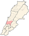
| Governorate | Mount Lebanon Governorate |
| District | Chouf District |
| Government | |
| Elevation | 750 m (2,460 ft) |
| Time zone | UTC+2 (EET) |
| • Summer (DST) | UTC+3 (EEST) |
| Dialing code | +961 |
Mazraat el Daher (Arabic: مزرعة الضهر) also spelled Maraat el Dahr, is a Lebanese village located in the Chouf District of the Mount Lebanon Governorate. The maximum elevation of the village is approximately 750 meters above sea level. The village lies approximately 54 km south of Beirut.[1]
External links
- Mazraat ed Dahr, Localiban
References
- ^ https://www.lebtivity.com/event/mazraat-el-daher-hiking-with-dale-corazon-lebanese-explorers
- v
- t
- e

Capital: Beitedine
- Ain Qani
- Ain W Zain
- Ain Zhalta
- Ainbal
- Ammatour
- Baadarâne
- Baakleen
- Bakaata
- Barja
- Barouk
- Batloun
- Beitedine
- Beykoun
- El Bireh
- Bourjein et Marjiyat
- Boutmeh
- Brih
- Bsaba
- Dahr El Maghara
- Damour
- Daraya
- Deir el Qamar
- Dibbiyeh
- El Foûâra
- Haret Jandal
- Gharife
- Jahlieh
- Jdaideh
- Jieh
- Joun
- Kahlouniye
- Kfarfakoud
- Kfar Nabrakh
- Mazraat el-Chouf
- Mazraat el Daher
- Maasser
- Moukhtara
- Mtolleh
- Na'ameh
- Niha
- Rmeileh
- Serjbel
- Shheem
- Symkanieh
- Zaarourieh
 | This Lebanon location article is a stub. You can help Wikipedia by expanding it. |
- v
- t
- e


