Mokrá Lúka
Municipality in Slovakia
48°40′N 20°09′E / 48.667°N 20.150°E / 48.667; 20.150 Slovakia
050 01 (pošta Revúca 1)
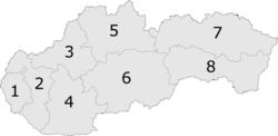
Mokrá Lúka (Hungarian: Vizesrét) is a village and municipality in Revúca District in the Banská Bystrica Region of Slovakia.

External links
 Media related to Mokrá Lúka at Wikimedia Commons
- Official website

- Mokrá Lúka village website (in Slovak)
- https://web.archive.org/web/20080111223415/http://www.statistics.sk/mosmis/eng/run.html
- v
- t
- e
Municipalities of Revúca District
- Držkovce
- Gemer
- Gemerská Ves
- Gemerské Teplice
- Gemerský Sad
- Hrlica
- Hucín
- Chvalová
- Chyžné
- Kameňany
- Leváre
- Levkuška
- Licince
- Lubeník
- Magnezitovce
- Mokrá Lúka
- Muráň
- Muránska Dlhá Lúka
- Muránska Huta
- Muránska Lehota
- Muránska Zdychava
- Nandraž
- Otročok
- Ploské
- Polina
- Prihradzany
- Rákoš
- Rašice
- Ratková
- Ratkovské Bystré
- Revúcka Lehota
- Rybník
- Sása
- Sirk
- Skerešovo
- Šivetice
- Turčok
- Višňové
- Žiar

 | This Banská Bystrica Region geography article is a stub. You can help Wikipedia by expanding it. |
- v
- t
- e


