Mount Sterling, Alabama
Unincorporated community in Alabama, United States
Unincorporated community in Alabama, United States
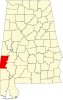
32°5′37″N 88°9′47″W / 32.09361°N 88.16306°W / 32.09361; -88.16306Mount Sterling is an unincorporated community in Choctaw County, Alabama, United States.[1] Mount Sterling was once a prosperous antebellum community, with an economy based on cotton and timber, but today little is left other than a few scattered houses. One church building, the Mount Sterling Methodist Church, is listed on the National Register of Historic Places.[2][3]
Mount Sterling's population as an unincorporated community was listed as 126 at the 1880 U.S. Census, the only time a figure was returned.
Demographics
| Census | Pop. | Note | %± |
|---|---|---|---|
| 1880 | 126 | — | |
| U.S. Decennial Census[4] | |||
Geography
Mount Sterling is located at 32°05′38″N 88°09′47″W / 32.09375°N 88.16307°W / 32.09375; -88.16307 and has an elevation of 164 feet (50 m).[1]
References
- ^ a b U.S. Geological Survey Geographic Names Information System: Mount Sterling, Alabama
- ^ Chiat, Marilyn Joyce Segal (1997). America's Religious Architecture: Sacred Places For Every Community. John Wiley and Sons. p. 279. ISBN 978-0-471-14502-8.
- ^ "National Register Information System". National Register of Historic Places. National Park Service. March 13, 2009.
- ^ "U.S. Decennial Census". Census.gov. Retrieved June 6, 2013.
- v
- t
- e
Municipalities and communities of Choctaw County, Alabama, United States
County seat: Butler
communities
- Barrytown
- Bladon Springs
- Cromwell
- Edna
- Jachin
- Melvin
- Mount Sterling
- Pushmataha
- Riderwood
- Robjohn
- Spring Hill
- Yantley
‡This populated place also has portions in an adjacent county or counties
- Alabama portal
- United States portal
 | This Choctaw County, Alabama state location article is a stub. You can help Wikipedia by expanding it. |
- v
- t
- e


