Nüdlingen
Municipality in Bavaria, Germany

Coat of arms
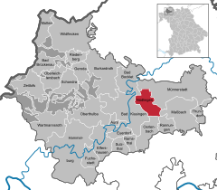
Location of Nüdlingen within Bad Kissingen district
(2022-12-31)[2]
97720
Nüdlingen is a municipality in the district of Bad Kissingen in Bavaria in Germany.
Divisions of the municipality
The municipality is divided into the following towns:
- Haard
- Nüdlingen
History
Nüdlingen was first mentioned in 772 in the records of the monastery at Fulda.
With secularization of the government in 1803, the territory of the present municipality became part of Bavaria. In the Treaty of Pressburg between France and Austria in 1805, the lands of the Bishop of Würzburg were given to Ferdinand III, Grand Duke of Tuscany, and he was made Grand Duke of Würzburg, a new state, as a reward for his support of Napoleon. These lands then again became part of Bavaria in 1814 (this time permanently) at the defeat of Napoleon.
Population
| Year | Population |
| 1970 | 3570 |
| 1987 | 3520 |
| 2000 | 4210 |
| 2005 | 4257 |
Economy
In 1998, there were 392 businesses in the municipality. In 1999, there were 39 agricultural businesses, with 1451 ha under cultivation, 1284 ha in fields, and 163 ha in pasture.
References
- ^ Liste der ersten Bürgermeister/Oberbürgermeister in kreisangehörigen Gemeinden, Bayerisches Landesamt für Statistik, 15 July 2021.
- ^ Genesis Online-Datenbank des Bayerischen Landesamtes für Statistik Tabelle 12411-003r Fortschreibung des Bevölkerungsstandes: Gemeinden, Stichtag (Einwohnerzahlen auf Grundlage des Zensus 2011) (Hilfe dazu).
External links
- Official website

- v
- t
- e
Towns and municipalities in Bad Kissingen (district)
- Aura
- Bad Bocklet
- Bad Brückenau
- Bad Kissingen
- Burkardroth
- Elfershausen
- Euerdorf
- Fuchsstadt
- Geroda
- Hammelburg
- Maßbach
- Motten
- Münnerstadt
- Nüdlingen
- Oberleichtersbach
- Oberthulba
- Oerlenbach
- Ramsthal
- Rannungen
- Riedenberg
- Schondra
- Sulzthal
- Thundorf
- Wartmannsroth
- Wildflecken
- Zeitlofs

Authority control databases | |
|---|---|
| International |
|
| National |
|


