Nara Visa, New Mexico
Unincorporated village in New Mexico, United States
35°36′55″N 103°06′35″W / 35.61528°N 103.10972°W / 35.61528; -103.10972[1] (2020)[3]
88430
Nara Visa is an unincorporated village and locus of a same-named census-designated place in Quay County, New Mexico, United States. It has the post office serving the ZIP code of 88430;[4] while the village is not specifically tracked by the Census Department, the population of the entire ZCTA for 88430 was 212 at the 2000 census.[5]
History
Nara Visa traces its beginnings to brothers Sim and Fred McFarland of La Veta, Colorado. The brothers originally came to New Mexico to work on their uncle's cattle ranch. When word came that the Rock Island Railroad would be building a track through the area, the McFarlands moved to a location near the proposed route.[6] The community was first known as Narvaez, named after the Narvaez family, who lived in the area in the 1880s.[7] English-speaking settlers changed the name into its current name Nara Visa.[8]
Henry F. King came to the site in November 1901 to be the first section foreman, when the town was founded. At that time, there were no structures aside from the depot. He and his wife lived in a boxcar where they boarded trainmen, section men, and occasionally cowboys. In January 1902, the section house was constructed. Soon two small stores were built.[6]
The community's first school was constructed in 1906. By 1910, there were a total of four active churches. In 1919, Nara Visa had eight saloons, at least three dance halls, drugs stores, general merchandise stores, a barber shop, butcher shops, millinery shops, auto suppliers, hotels, garages, and a bank.[6]
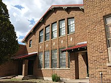
In 1921, the Nara Visa School was constructed. It closed and currently is a community center.
Demographics
| Census | Pop. | Note | %± |
|---|---|---|---|
| 2020 | 51 | — | |
| U.S. Decennial Census[9][3] | |||
Transportation
U.S. Route 54 passes through this community. NM 402 ends at Nara Visa.
The Union Pacific Railroad passes through Nara Visa, but there are no sidings.
See also
References
- ^ a b c U.S. Geological Survey Geographic Names Information System: Nara Visa, New Mexico
- ^ "ArcGIS REST Services Directory". United States Census Bureau. Retrieved October 12, 2022.
- ^ a b "Census Population API". United States Census Bureau. Retrieved October 12, 2022.
- ^ Zip Code Lookup
- ^ "88430 - Fact Sheet - American FactFinder". Archived from the original on February 10, 2020. Retrieved February 24, 2008.
- ^ a b c Moncus, Mary Lynn; Marian Farmer Knapp, eds. (1985). Quay County. Quay County Book Committee. pp. 154–159.
- ^ Moncus, Mary Lynn; Marian Farmer Knapp, eds. (1985). Quay County. Quay County Book Committee. p. 62.
- ^ Nara Visa history
- ^ "Census of Population and Housing". Census.gov. Retrieved June 4, 2016.
External links
 Media related to Nara Visa, New Mexico at Wikimedia Commons
- v
- t
- e
Municipalities and communities of Quay County, New Mexico, United States
County seat: Tucumcari

- Nara Visa
unincorporated
communities
‡This populated place also extends into Texas
- New Mexico portal
- United States portal
Authority control databases | |
|---|---|
| International |
|
| National |
|
 | This New Mexico state location article is a stub. You can help Wikipedia by expanding it. |
- v
- t
- e


