Olivenhain, Encinitas, California
Neighborhood in Encinitas, California, United States
Neighborhood of Encinitas in San Diego, California, United States
33°02′46″N 117°14′05″W / 33.04611°N 117.23472°W / 33.04611; -117.2347292024
Olivenhain is a neighborhood in the city of Encinitas, California, located in the North County area of San Diego County. It is the easternmost community of Encinitas, bordering the western portion of Rancho Santa Fe.
The community of Olivenhain is primarily single family custom homes with relatively large lots. Minimum lot sizes range from 0.5 acres (2,000 m2) to 5 acres (20,000 m2). The topography tends to be rolling, and most streets are small and wind through the hills. Olivenhain has a vast network of recreational trails, used by walkers and equestrians. A common sight in the area during late afternoons and dusk are hot air balloons. Olivenhain has a darker sky than coastal San Diego towns due to its "Dark Sky Policy" which restricts lights from street lights, tennis courts, and other forms of light pollution.
History
The area is located on the Rancho Las Encinitas Mexican land grant, and was settled by a German colony in the 1890s. The name Olivenhain is from German and means "olive grove".[1][2][3] The German settlers built the meeting hall which still stands. It is used today for community functions such as the annual Oktoberfest, Haunted House, summer movie series, craft fairs and a variety of civic group meetings. Residents of Olivenhain may schedule the Meeting Hall and grounds for private functions; it is a popular wedding site.[4]
Originally an unincorporated community, in 1986 Olivenhain joined with the nearby communities of Leucadia, Cardiff-by-the-Sea, and Encinitas to form the incorporated city of Encinitas.[5]
Education
Olivenhain is located within the Encinitas Union School District and the San Dieguito Union High School District. Elementary students attend Olivenhain Pioneer Elementary, then Diegueño Middle School. Public High School students attend La Costa Canyon High School or San Dieguito Academy. There also are several private schools nearby.
Photos
-
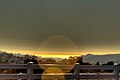 View of the Pacific Ocean from Olivenhain, CA.
 -
 Hot air balloons are a common sight during late afternoons and dusk over Olivenhain, CA.
 -
 The Olivenhain Meeting Hall.


References
- ^ Richard Bumann, 1981, Colony Olivenhain, ISBN 978-0-9607112-0-8
- ^ Colony Olivenhain
- ^ Las Encinitas Rancho and "Olivenheim"
- ^ Colony Olivenhain
- ^ Andreen, Mike (August 16, 2011). "Tale of Incorporation: How Encinitas Became an Entity Onto Itself 25 Years Ago". Encinitas Patch. Retrieved 29 July 2018.
- v
- t
- e
Municipalities and communities of San Diego County, California, United States
County seat: San Diego

- Alpine
- Bonita
- Bonsall
- Borrego Springs
- Bostonia
- Boulevard
- Campo
- Camp Pendleton Mainside
- Camp Pendleton South
- Casa de Oro-Mount Helix
- Crest
- Del Dios
- Descanso
- Elfin Forest
- Eucalyptus Hills
- Fairbanks Ranch
- Fallbrook
- Granite Hills
- Harbison Canyon
- Harmony Grove
- Hidden Meadows
- Jacumba Hot Springs
- Jamul
- Julian
- Lake San Marcos
- Lakeside
- La Presa
- Mount Laguna
- Pala
- Pine Valley
- Potrero
- Rainbow
- Ramona
- Rancho San Diego
- Rancho Santa Fe
- San Diego Country Estates
- Spring Valley
- Valley Center
- Winter Gardens
communities
- 4S Ranch
- Ballena
- Banner
- Casa de Oro
- De Luz
- De Luz Heights
- Dehesa
- Dulzura
- East Otay Mesa
- Flinn Springs
- Foster
- Guatay
- Jesmond Dene
- Kentwood-In-The-Pines
- Lincoln Acres
- Manzanita
- Oak Grove
- Ocotillo Wells
- Pala Mesa
- Palomar Mountain
- Pauma Valley
- Pine Hills
- Ranchita
- Rincon
- San Luis Rey
- Santa Ysabel
- Shelter Valley
- Tecate
- Warner Springs
- Wynola
reservations
- Barona Reservation
- Campo Indian Reservation
- Capitan Grande Reservation
- Ewiiaapaayp Indian Reservation
- Inaja and Cosmit Reservation
- Jamul Indian Village
- La Jolla Indian Reservation
- La Posta Reservation
- Los Coyotes Indian Reservation
- Manzanita Reservation
- Mesa Grande Reservation
- Pala Indian Reservation
- Pauma and Yuima Indian Reservation
- Rincon Indian Reservation
- San Pasqual Reservation
- Santa Ysabel Reservation
- Sycuan Band Reservation
- Viejas Reservation
- California portal
- United States portal
Authority control databases | |
|---|---|
| International |
|
| National |
|


