Quincy, Illinois, micropolitan area
Micropolitan Statistical Area in the United States
Quincy, IL Quincy, Illinois Micropolitan Statistical Area | ||
|---|---|---|
Micropolitan Statistical Area | ||
 | ||
 Map of Quincy–Hannibal, IL–MO CSA
| ||
| Country |  United States United States | |
| State |  Illinois Illinois Missouri Missouri | |
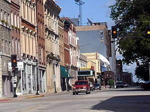
| Principal city | Quincy, Illinois | |
| Largest city | Hannibal, Missouri | |
| Population (2020) | ||
| • Total | 114,649 | |
| Time zone | UTC−6 (CST) | |
| • Summer (DST) | UTC−5 (CDT) | |
The Quincy–Hannibal, IL–MO Combined Statistical Area, as defined by the United States Census Bureau, is an area consisting of one county in Western Illinois and three counties in northeast Missouri, anchored by the cities of Quincy and Hannibal.
As of the 2020 census, the μSA had a population of 114,649.[1]
Counties
In Illinois
In Missouri
Communities
All populations are based on the 2012 census.
Anchor Cities
Places with 1,000 to 5,000 inhabitants
- Vandalia (partial) Pop: 4,017 (~2,000 are inmates at a local prison)
- Palmyra Pop: 3,610
- Monroe City (partial) Pop: 2,485
- Canton Pop: 2,376
- Camp Point Pop: 1,129
- Payson Pop: 1,020
Places with 500 to 1,000 inhabitants
- New London Pop: 981
- Mendon Pop: 948
- La Grange Pop: 931
- Clayton Pop: 704
- Perry Pop: 702
- La Belle Pop: 656
- Golden Pop: 641
- Ursa Pop: 626
- Lewistown Pop: 530
- Liberty Pop: 516
- Center Pop: 512
Places with less than 500 inhabitants
- Ewing Pop: 452
- Loraine Pop: 313
- Plainville Pop: 264
- Rennselaer Pop: 231
- Lima Pop: 163
- Coatsburg Pop: 147
- Columbus Pop: 99
- Monticello Pop: 98
- La Prairie Pop: 47
Unincorporated places
- Beverly
- Bigneck also spelled Big Neck
- Burton
- Durham
- Fall Creek
- Fowler
- Hickory Grove
- Kellerville
- Kingston
- Marblehead
- Marcelline
- Maywood
- Meyer
- North Quincy
- Paloma
- Philadelphia
- Richfield
- Steffenville
- Taylor
- West Quincy
- Williamstown
Demographics
As of the census[2] of 2000, there were 78,771 people, 30,816 households, and 20,705 families residing within the μSA. The racial makeup of the μSA was 95.21% White, 3.00% African American, 0.16% Native American, 0.37% Asian, 0.01% Pacific Islander, 0.33% from other races, and 0.92% from two or more races. Hispanic or Latino of any race were 0.82% of the population.
The median income for a household in the μSA was $32,718, and the median income for a family was $39,937. Males had a median income of $29,475 versus $20,381 for females. The per capita income for the μSA was $16,320.
In 2015 Quincy, Illinois was named as a finalist for the All-American City.[3]
Education
Quincy, IL is home to institutions of higher education including John Wood Community College,[4] and Quincy University.[5]
Transportation
Quincy Transit Lines serves the Quincy area. The Carl Sandburg and Illinois Zephyr Amtrak trains serve Quincy station.
See also
References
- ^ "U.S. Census Bureau QuickFacts: Adams County, Illinois; Lewis County, Missouri; Marion County, Missouri; Ralls County, Missouri". www.census.gov. Retrieved 2023-10-16.
- ^ "U.S. Census website". United States Census Bureau. Retrieved 2008-01-31.
- ^ "Quincy Named A Finalist for 2015 All-American City Award". 2016-03-04. Archived from the original on 2016-03-04.
- ^ "About John Wood Community College". JWCC. Retrieved April 6, 2015.
- ^ "Quincy University". Retrieved April 6, 2015.
External links
- Census [dead link]
- v
- t
- e
Municipalities and communities of Adams County, Illinois, United States
County seat: Quincy

communities
- Illinois portal
- United States portal
Municipalities and communities of Lewis County, Missouri, United States | ||
|---|---|---|
County seat: Monticello | ||
| Cities |  | |
| Village | ||
| Townships | ||
| CDP | ||
| Other communities | ||
| Ghost town | ||
| ||


39°56′N 91°23′W / 39.933°N 91.383°W / 39.933; -91.383


