Schlehdorf
Municipality in Bavaria, Germany

Coat of arms
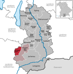
Location of Schlehdorf within Bad Tölz-Wolfratshausen district
(2020–26) Stefan Jocher[1]
(2022-12-31)[2]
82444
Schlehdorf is a municipality in the district of Bad Tölz-Wolfratshausen in Bavaria in Germany. Schlehdorf Abbey is located there.
-
 Schlehdorf chapel
 -
 Seestraße
 -
 Mittelstraße
 -
 Karpfseestraße
 -
 Kocheler Straße


References
Wikimedia Commons has media related to Schlehdorf.
- ^ Liste der ersten Bürgermeister/Oberbürgermeister in kreisangehörigen Gemeinden, Bayerisches Landesamt für Statistik, accessed 19 July 2021.
- ^ Genesis Online-Datenbank des Bayerischen Landesamtes für Statistik Tabelle 12411-003r Fortschreibung des Bevölkerungsstandes: Gemeinden, Stichtag (Einwohnerzahlen auf Grundlage des Zensus 2011) (Hilfe dazu).
- v
- t
- e
Towns and municipalities in Bad Tölz-Wolfratshausen
- Bad Heilbrunn
- Bad Tölz
- Benediktbeuern
- Bichl
- Dietramszell
- Egling
- Eurasburg
- Gaißach
- Geretsried
- Greiling
- Icking
- Jachenau
- Kochel
- Königsdorf
- Lenggries
- Münsing
- Reichersbeuern
- Sachsenkam
- Schlehdorf
- Wackersberg
- Wolfratshausen

Authority control databases | |
|---|---|
| International |
|
| National |
|
| Geographic |
|
 | This Bad Tölz-Wolfratshausen location article is a stub. You can help Wikipedia by expanding it. |
- v
- t
- e


