Singhi Kangri
Peak in the Karakoram range, located on the border between China and India

Singhi Kangri
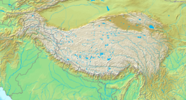
Location on a map of the Tibetan Plateau
Ranked 108th
Singhi Kangri is a 7,202 m (23,629 ft) peak in the Karakoram range.[1] It is located on the border between China and India. The mountain was first climbed in 1976 by a Japanese expedition.[1]
See also
References
- ^ a b c "India 2006" (PDF). AlpineJournal.org.UK. Retrieved 28 September 2014. Note: Sources vary. This peak's elevation is frequently quoted at 7207m and also as low as 7172m.
External links
- "Singhi Kangri" on Peakbagger
- "Singhi Kangri". Peakware.com. Archived from the original on 4 March 2016.
- v
- t
- e
 | This Ladakh, India location article is a stub. You can help Wikipedia by expanding it. |
- v
- t
- e


