Southern Ute, Colorado
Census-designated place in La Plata County, Colorado, United States
Census-designated place in Colorado, United States
37°04′30″N 107°35′36″W / 37.0748875°N 107.5933083°W / 37.0748875; -107.5933083 (Southern Ute CDP, Colorado)[1] United States
 Colorado
 (2020)[3]
Ignacio 81137
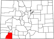
Southern Ute is a census-designated place (CDP) on the Southern Ute Indian Reservation in southern La Plata County, Colorado, United States. The CDP is a part of the Durango, CO Micropolitan Statistical Area. The population of the Southern Ute CDP was 158 at the United States Census 2020.[3] The Ignacio post office (Zip Code 81137) serves the area.[4]
Etymology
Southern Ute is named for the Southern Ute people and the Southern Ute Indian Reservation.
Geography
The Southern Ute CDP has an area of 10,214 acres (41.335 km2), all land.[1]
Demographics
| Year | Pop. | ±% |
|---|---|---|
| 2010 | 177 | — |
| 2020 | 158 | −10.7% |
| Source: United States Census Bureau | ||
The United States Census Bureau initially defined the Southern Ute CDP for the United States Census 2010.
See also
 Colorado portal

References
- ^ a b c "State of Colorado Census Designated Places - BAS20 - Data as of January 1, 2020". United States Census Bureau. Retrieved December 22, 2020.
- ^ a b c "U.S. Board on Geographic Names: Domestic Names". United States Geological Survey. Retrieved December 22, 2020.
- ^ a b United States Census Bureau. "Southern Ute CDP, Colorado". Retrieved April 5, 2023.
- ^ a b "Zip Code 81137 Map and Profile". zipdatamaps.com. 2020. Retrieved December 22, 2020.
External links
Wikimedia Commons has media related to Southern Ute, Colorado.
- Southern Ute Indian Tribe website
- La Plata County website
- v
- t
- e
Municipalities and communities of La Plata County, Colorado, United States
County seat: Durango
- Marvel
- Southern Ute
communities
reservations
‡This populated place also has portions in an adjacent county or counties
- Colorado portal
- United States portal
Authority control databases | |
|---|---|
| International |
|
| National |
|


