Sycamore, California
Unincorporated community in California, United States
39°08′02″N 121°56′31″W / 39.13389°N 121.94194°W / 39.13389; -121.94194
Unincorporated community in California, United States


Sycamore
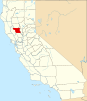
Location in California
Show map of California
Sycamore
Sycamore (the United States)
Show map of the United StatesSycamore (formerly, Loch-loch) is an unincorporated community in Colusa County, California. It lies near the mouth of Sycamore Slough, at an elevation of 49 feet (15 m).
References
- ^ U.S. Geological Survey Geographic Names Information System: Sycamore, California
- U.S. Geological Survey Geographic Names Information System: Sycamore, California
- v
- t
- e
Municipalities and communities of Colusa County, California, United States
County seat: Colusa
- Colusa
- Williams
- Arbuckle
- College City
- Grimes
- Lodoga
- Maxwell
- Princeton
- Stonyford
communities
- Delevan
- Fouts Springs
- Genevra
- Grand Island
- Leesville
- Sites
- Sycamore
reservations
‡This populated place also has portions in an adjacent county or counties
- California portal
- United States portal
 | This Colusa County, California-related article is a stub. You can help Wikipedia by expanding it. |
- v
- t
- e


