Distrito de Morang
| Distrito de Morang | ||
|---|---|---|
| Distrito | ||
 | ||
 | ||
| Coordenadas | 26°40′00″N 87°30′00″E / 26.666666666667, 87.5 | |
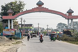
| Capital | Biratnagar | |
| Idioma oficial | nepalí | |
| Entidad | Distrito | |
| • País |  Nepal Nepal | |
| • Zona administrativa | Kosi | |
| Superficie | ||
| • Total | 1.855 km² | |
| Población (2011[1]) | ||
| • Total | 965,370 hab. | |
| • Densidad | 454,6 hab./km² | |
[editar datos en Wikidata] | ||
El distrito de Morang es uno de los seis distritos que conforman la Zona de Kosi, en Nepal.
Comités de desarrollo rural
En el distrito se encuentran los siguientes comités de desarrollo rural:
- Amaibariyati
- Amardaha
- Amgachhi
- Babiya Birta
- Bahuni
- Bairban
- Banigama
- Baradanga
- Bayarban
- Belbari
- Bhaudaha
- Bhogateni
- Biratnagar
- Budhanagar
- Dainiya
- Dangihat
- Dangraha
- Darbairiya
- Drabesh
- Dulari
- Govindapur
- Haraicha
- Hasandaha
- Hathimudha
- Hoklabari
- Indrapur
- Itahara
- Jante
- Jhapa Baijanathpur
- Jhorahat
- Jhurkiya
- Kadamaha
- Kaseni
- Katahari
- Kathamaha
- Kerabari
- Keron
- Lakhantari
- Letang
- Madhumalla
- Mahadeva
- Majhare
- Matigachha
- Motipur
- Mrigauliya
- Necha
- Pathari
- Patigaun
- Pokhariya
- Rajghat
- Ramite Khola
- Rangeli
- Sanischare
- Sidharaha
- Sijuwa
- Sinhadevi Sombare
- Sisabanibadahara
- Sisawanijahada
- Sorabhaj
- Sundarpur
- Takuwa
- Tandi
- Tankisinuwari
- Tetariya
- Thalaha
- Urlabari
- Warangi
- Yangshila
Referencias
- ↑ Household and population by districts, Central Bureau of Statistics (CBS) Nepal
Enlaces externos
- Districts of Nepal (en inglés).
- Mapa del distrito de Morang.
- Morang District Profile & Annual Report (en inglés).


