Monticello, Indiana
| Monticello | |
| city | |
 Monticello Carnegie Library | |
| Land |  USA USA |
|---|---|
| Delstat | Indiana |
| County | White County |
| Koordinater | 40°44′42″N 86°46′2″V / 40.74500°N 86.76722°V / 40.74500; -86.76722 |
| Yta | 9,5 km² (2010)[1] |
| - land | 9 km² |
| - vatten | 0,6 km² |
| Folkmängd | 5 378 (2010)[2] |
| Befolkningstäthet | 598 invånare/km² |
| Tidszon | EST (UTC-5) |
| - sommartid | EDT (UTC-4) |
| ZIP-kod | 47960[3] |
| FIPS | 1850760 |
| Geonames | 4923745 |
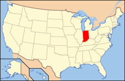
  Ortens läge i Indiana | |
 Indianas läge i USA | |
| Webbplats: http://www.monticelloin.gov/ | |
Monticello är en stad (city) i den amerikanska delstaten Indiana med en yta av 7,8 km² och en folkmängd, som uppgår till 5 723 invånare (2000). Monticello är administrativ huvudort i White County.
Kända personer från Monticello
- DJ Ashba, gitarrist och låtskrivare
- Charles S. Hartman, politiker
Källor
- ^ ”2010 Census Gazetteer Files”. US Census Bureau. Arkiverad från originalet den 14 juli 2012. https://www.webcitation.org/699nOulzi?url=http://www.census.gov/geo/www/gazetteer/files/Gaz_places_national.txt. Läst 14 juli 2012.
- ^ ”Monticello (city), Indiana” (på engelska). State & County Quickfacts. U.S. Census Bureau,. Arkiverad från originalet den 6 augusti 2012. https://www.webcitation.org/69i8iCJ3b?url=http://quickfacts.census.gov/qfd/states/18/1850760.html. Läst 6 augusti 2012.
- ^ ”2010 ZIP Code Tabulation Area (ZCTA) Relationship Files”. U.S. Census Bureau. 24 maj 2010. Arkiverad från originalet den 25 augusti 2012. https://www.webcitation.org/6ABdwXxbq?url=http://www.census.gov/geo/www/2010census/zcta_rel/zcta_place_rel_10.txt. Läst 25 augusti 2012.
Externa länkar
 Wikimedia Commons har media som rör Monticello, Indiana.Bilder & media
- Monticello Herald Journal
|


