Hormozgan province
Province of Iran
Province in Region 2, Iran
Hormozgan Province Persian: استان هرمزگان | |
|---|---|
Province | |
 Map of Iran with Hormozgan province highlighted | |
| Coordinates: high · 25th |

Hormozgan province (Persian: استان هرمزگان)[a] is one of the 31 provinces of Iran. Its capital is the city of Bandar Abbas.[4] The province is in the south of the country, in Iran's Region 2.[5] facing Oman, the United Arab Emirates and the Hormuz Straits. Its area is 70,697 km2 (27,296 sq mi),[6] The province has 14 islands in the Persian Gulf and 1,000 km (620 mi) of coastline.
At the time of the 2006 National Census, the Hormuzgan province population was recorded as 1,365,377 people in 303,323 households.[7] In the following census in 2011, the population had increased to 1,578,183 in 396,927 households.[8] By the time of the last census conducted in 2016, the population had risen to 1,776,415 in 493,660 households.[2]
History
Although Hormozgan is known to have been settled during the Achaemenid era when Nearchus passed through the region, recorded history of the main port of Hormozgan (Bandar‑e Hormoz) begins with Ardashir I of Persia of the Sassanid empire.
The province is said to have been particularly prosperous between 241 BC and 211 BC, but grew even further in trade and commercial significance with the beginning of the Islamic era.
Marco Polo visited the port of Bandar Abbas in 1272 and 1293. He reported widespread trading in Persian jewelry, ivory and silk of Indochina, and pearls from Bahrain in the bazaars of the port of Hormuz.
In 1497 Europeans landed in the region for the first time, headed by Vasco da Gama. In 1508 the Portuguese, led by Afonso de Albuquerque invaded the area with seven warships, under the pretext of protecting their interests from Egypt and Venice. The port of Hormuz at the time was considered strategically positioned for commercial interests in the Persian Gulf.
Ismail I who was trying to counter the Ottoman Empire to the west, was unable to save the port from the Portuguese, until Shah Abbas I was finally able to drive them out of the Persian Gulf with the aid of the British. The name of Bandar Abbas comes directly from the name of Shah Abbas I.
The British, meanwhile, were competing for influence in the region with Dutch colonialists, who invaded Qeshm Island and dispatched warships to Bandar Abbas during the final years of Shah Abbas' reign. The Persian government was unable to defend itself against this attack. However, with the souring of British and Dutch relations, military tensions grew in the region. The Dutch finally resorted to moving their base up to Kharg Island. The Amir of Kharg, Mir Mahna Baloch and Mir Hamal Kalmati with Baloch army defeated the Europeans from Bander Abbas till Karachi, so with the Dutch and other forces at Kharg, the British were firmly in charge of the entire region. Soon Britain took control over the entire Persian Gulf via the British East India Company. The British adopted policy encouraging local autonomy throughout the Persian Gulf to in order to prevent a formidable unified force from threatening their establishments in the gulf.
The strategic importance of the Persian Gulf further increased after World War I with the discovery of oil in the region.
Geography and climate
The province is primarily mountainous, consisting of the southern tip of the Zagros Range. The province experiences a very hot and humid climate, with temperatures sometimes exceeding 120 °F (49 °C) in summers. There is very little precipitation year-round.
Administrative divisions

The population history and structural changes of Hormozgan province's administrative divisions over three consecutive censuses are shown in the following table.
| Counties | 2006[7] | 2011[8] | 2016[2] |
|---|---|---|---|
| Abumusa | 1,860 | 5,263 | 7,402 |
| Bandar Abbas | 498,644 | 588,288 | 680,366 |
| Bandar Lengeh | 113,625 | 134,713 | 159,358 |
| Bashagard[b] | — | 40,007 | 35,085 |
| Bastak | 65,716 | 80,119 | 80,492 |
| Hajjiabad | 62,442 | 65,889 | 69,625 |
| Jask | 75,769 | 52,882 | 58,884 |
| Khamir | 47,545 | 52,968 | 56,148 |
| Minab | 254,304 | 235,705 | 259,221 |
| Parsian | 37,369 | 42,843 | 50,596 |
| Qeshm | 103,881 | 117,774 | 148,993 |
| Rudan | 104,222 | 118,547 | 124,522 |
| Sirak[c] | — | 43,185 | 45,723 |
| Total | 1,365,377 | 1,578,183 | 1,776,415 |
Cities
According to the 2016 census, 976,652 people (nearly 55% of the population of Hormozgan province) live in the following cities:[2]
| City | Population |
|---|---|
| Abu Musa | 4,213 |
| Bandar Abbas | 526,648 |
| Bandar Charak | 4,066 |
| Bandar Khamir | 20,150 |
| Bandar Lengeh | 30,435 |
| Bastak | 9,959 |
| Bika | 7,190 |
| Dargahan | 14,525 |
| Dashti | 4,695 |
| Fareghan | 1,773 |
| Fin | 3,939 |
| Garuk | 4,008 |
| Gowharan | 1,170 |
| Hajjiabad | 28,977 |
| Hasht Bandi | 6,718 |
| Hormuz | 5,891 |
| Jask | 16,860 |
| Jenah | 6,910 |
| Kish | 39,853 |
| Kong | 19,213 |
| Kuhestak | 3,060 |
| Kushk-e Nar | 3,260 |
| Lamazan | 2,745 |
| Minab | 73,170 |
| Parsian | 18,045 |
| Qaleh Qazi | 5,286 |
| Qeshm | 40,678 |
| Rudan | 36,121 |
| Ruydar | 6,558 |
| Sardasht | 1,725 |
| Sar-e Gaz-e Ahmadi | 1,157 |
| Senderk | 1,915 |
| Sirik | 5,137 |
| Suza | 5,707 |
| Takht | 3,082 |
| Tazian-e Pain | 4,263 |
| Tirur | 4,871 |
| Ziarat-e Ali | 2,679 |
Most populous cities
The following table lists the most populous cities in Hormozgan:[2]
| Rank | City | County | Population |
|---|---|---|---|
| 1 | Bandar Abbas | Bandar Abbas | 526,648 |
| 2 | Minab | Minab | 73,170 |
| 3 | Qeshm | Qeshm | 40,678 |
| 4 | Kish | Bandar Lengeh | 39,853 |
| 5 | Rudan | Rudan | 36,121 |
| 6 | Bandar Lengeh | Bandar Lengeh | 30,435 |
| 7 | Hajjiabad | Hajjiabad | 28,977 |
| 8 | Kong | Bandar Lengeh | 19,213 |
| 9 | Parsian | Parsian | 18,045 |
| 10 | Jask | Jask | 16,860 |
Languages
Hormozgan is dominated by a variety of Iranian languages primarily of the Southwestern branch which are closely related to the Persian language, but Northwest Iranian Balochi is present as well. Arabic, a Semetic language, and Kholosi, an Indic language, are also found among a minority of speakers within the province.
Hormozgan today
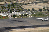
Hormozgan today has 11 ports, five national airports, and three international airports. The province has an active agriculture sector, ranking first in Iran in lime production and second in date production. 30% of Iran's fishery produce comes from this province. Three major hydro dams serve the water needs of the province — Esteghlal Dam (i.e., Minab Dam, which supplies major part of consuming water of the Bandar Abbas), Jegin Dam, and Shemil Dam.
Germany has recently[when?] offered to build a bridge that would connect Qeshm island to the mainland, a formidable project.
Hormozgan has two free trade zones, one in Kish, the other on Qeshm island. Kish Island, situated in a free-trade zone, is home of the Iranian oil bourse (one of five exchanges of its kind in the world, and the only one explicitly not trading oil and derivatives in U.S. dollars).
Attractions
The Cultural Heritage Organization of Iran lists 212 sites of historical and cultural significance in the province. Some of the more popular attractions are:
- Emarat-e Kolah Farangi (built by and during the Dutch occupation)
- Berkeh haye Baran (six traditional water reservoirs)
- Gele-dari traditional bath
- The Hindu temple
- Latidan Bridge, built during the era of Shah Abbas I
- Fekri House
- Sa'di House
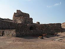
- Fort of Our Lady of the Conception in Hormoz island
- Qeshm Island
- Hara marine forests
- Kish Island, the most popular tourist resort in southern Iran in the Persian Gulf
- Geno UNESCO natural biosphere reserve
- Hara UNESCO natural biosphere reserve
- Various hot water springs
Colleges and universities
- Bandar Abbas University of Medical Sciences
- University of Hormozgan
- Qeshm Institute of Higher Education
- Islamic Azad University of Bandar Abbas
- Payame Noor University of Hormozgan
- Islamic Azad University of Roudan Archived 2017-10-10 at the Wayback Machine
- Kish University
See also
- Bandar Abbas
- Bastak
- Kookherd
- Maghoh
- Mir-Mahna (video game)
- Morbagh
- Ormus
- The Historic Bath of Siba – An ancient bath house that is believed dated back to the Sassanid dynasty.
![]() Media related to Hormozgan Province at Wikimedia Commons
Media related to Hormozgan Province at Wikimedia Commons
 Iran portal
Notes
- ^ Also romanized as Ostān-e Hormozgān
- ^ Separated from Jask County after the 2006 census[9]
- ^ Separated from Minab County after the 2006 census[10]
References
- ^ OpenStreetMap contributors (23 May 2024). "Hormozgan Province" (Map). OpenStreetMap. Retrieved 23 May 2024.
- ^ a b c d e "Census of the Islamic Republic of Iran, 1395 (2016)". AMAR (in Persian). The Statistical Center of Iran. p. 22. Archived from the original (Excel) on 5 May 2022. Retrieved 19 December 2022.
- ^ "Sub-national HDI – Area Database – Global Data Lab". hdi.globaldatalab.org. Retrieved 13 September 2018.
- ^ Habibi, Hassan (21 June 1369). "Approval of the organization and chain of citizenship of elements and units of Hormozgan province's national divisions centered in Bandar Abbas city". Laws and Regulations Portal of the Islamic Republic of Iran (in Persian). Ministry of Interior, Defense Political Commission of the Government Council. Archived from the original on 24 February 2022. Retrieved 9 February 2024.
- ^ "همشهری آنلاین-استانهای کشور به ۵ منطقه تقسیم شدند (Provinces were divided into 5 regions)". Hamshahri Online (in Persian). 22 June 2014 [1 Tir 1393, Jalaali]. Archived from the original on 23 June 2014.
- ^ SCI.org[permanent dead link]
- ^ a b "Census of the Islamic Republic of Iran, 1385 (2006)". AMAR (in Persian). The Statistical Center of Iran. p. 22. Archived from the original (Excel) on 20 September 2011. Retrieved 25 September 2022.
- ^ a b "Census of the Islamic Republic of Iran, 1390 (2011)" (Excel). Syracuse University (in Persian). The Statistical Center of Iran. p. 22. Retrieved 19 December 2022.
- ^ Davoodi, Parviz (28 July 1387). "Divisional changes and reforms in Hormozgan province". Laws and Regulations Portal of the Islamic Republic of Iran (in Persian). Ministry of Interior, Board of Ministers. Archived from the original on 6 September 2023. Retrieved 6 September 2023.
- ^ Davodi, Parviz (14 April 2018). "Approval letter regarding the reforms of country divisions in Hormozgan province". Islamic Parliament Research Center of the Islamic Republic of Iran (in Persian). Ministry of Interior, Political-Defense Commission. Archived from the original on 3 April 2019. Retrieved 23 November 2023.
- ^ "Language distribution: Hormozgan Province". 2020. Retrieved 27 August 2023.
Further reading
- Afshar Sistani, Iraj, Shenakht-e ostan-e Hormozgan, Tehran 2000
- Barbera, Gerardo, "Hormozgan: Situação linguística e aspectos culturais", Âyiné. International Journal of Islamic Societies and Cultures, 1, 2013, pp. 130–147
External links
- Official website of Hormozgan Governorship
- Hormozgan Cultural Heritage Organization
- Hara UNESCO Biosphere Reserve
- Geno UNESCO Biosphere Reserve
Places adjacent to Hormozgan province | |
|---|---|


Authority control databases | |
|---|---|
| National |
|
| Geographic |
|

Hormozgan Province, Iran | |||||||||||||||||||||||||
|---|---|---|---|---|---|---|---|---|---|---|---|---|---|---|---|---|---|---|---|---|---|---|---|---|---|
| Capital |  | ||||||||||||||||||||||||
| Counties and cities |
| ||||||||||||||||||||||||
| Sights |
| ||||||||||||||||||||||||
| populated places | |||||||||||||||||||||||||
| See also | |||||||||||||||||||||||||


