Northside, Lexington
Place in Kentucky, United States
Northside | |
|---|---|
Neighborhood of Lexington, Kentucky | |
 A residential neighborhood in Lexington's Northside | |
| Country | United States |
| State | Kentucky |
| County | Fayette |
| City | Lexington |
| Area | |
| • Total | 0.572 sq mi (1.48 km2) |
| Population (2000) | |
| • Total | 3,875 |
| • Density | 6,774/sq mi (2,618.2/km2) |
| Time zone | UTC-5 (Eastern (EST)) |
| • Summer (DST) | UTC-4 (EDT) |
| ZIP code | 40507, 40508 |
| Area code | 859 |
Northside is a neighborhood in northern Lexington, Kentucky, United States. Its boundaries are Loudon Avenue to the north and east, Short Street, Midland Avenue, and Winchester Road to the south, and Newtown Pike to the west.[1]
Neighborhood statistics
- Population in 2000: 3,875
- Land area: 0.572 square miles (1.48 km2)
- Population density: 6,774 people per square mile (2,615 people/km2)
- Median household income: $26,159[1]
Gallery
Numerous buildings and corridors in Lexington's Northside neighborhood are on the National Register of Historic Places, including:
-
 Matthew Kennedy House
 -
 McCracken-Wilgus House
 -
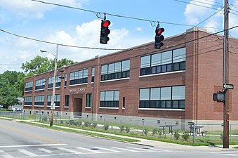 Russell School


References
- ^ a b Northside Neighborhood Profile city-data.com. Retrieved on 2011-01-01
- v
- t
- e
Lexington-Fayette


landmarks
- Alumni Gym Fitness Center
- Ashland
- Aviation Museum of Kentucky
- Bell Soccer Complex
- Calumet Farm
- Central Bank Center
- City Center
- Fayette National Bank Building
- Gratz Park
- Hunt–Morgan House
- Keeneland
- Kentucky Horse Park
- Kentucky Proud Park
- Kentucky Theatre
- Kroger Field
- Lexington Brewing and Distilling Company
- Lexington Cemetery
- Lexington Financial Center
- Lexington History Center
- Counter Clocks Field
- Mary Todd Lincoln House
- McConnell Springs
- Memorial Coliseum
- Mount Horeb Earthworks Complex
- Patterson Office Tower
- Pope Villa
- The Red Mile
- Singletary Center for the Arts
- University of Kentucky Art Museum
- Waveland State Historic Site
universities
- Bluegrass Community and Technical College
- Indiana Wesleyan University-Lexington
- Lexington Theological Seminary
- Midway University-Lexington
- National College–Lexington
- Sullivan University-Lexington
- Transylvania University
- University of Kentucky
- Kentucky Wildcats
- Lexington Legends
- Transylvania Pioneers
- KHSAA Commonwealth Gridiron Bowl
- KHSAA Sweet Sixteen (boys & girls)
38°03′N 84°29′W / 38.050°N 84.483°W / 38.050; -84.483


