California Historical Landmarks in Mendocino County
Places in Mendocino County that have been determined to have statewide historical significance
Map all coordinates using OpenStreetMap
Download coordinates as:
- KML
- GPX (all coordinates)
- GPX (primary coordinates)
- GPX (secondary coordinates)
List table of the properties and districts — listed on the California Historical Landmarks — within Mendocino County, California.
- Note: Click the "Map of all coordinates" link to the right to view a Google map of all properties and districts with latitude and longitude coordinates in the table below.
Listings
| Image | [1] | Landmark name | Location | City or town | Summary |
|---|---|---|---|---|---|
 | 615 | Fort Bragg | 343 N. Main St. 39°26′42″N 123°48′22″W / 39.44488°N 123.80609°W / 39.44488; -123.80609 (Fort Bragg) | Fort Bragg | The site of the original U.S. Army fort is the landmark, not the municipality that is currently there by the same name. The plaque identifying the designation is in front of the home of the town's first mayor, one of the few buildings to survive the 1906 earthquake. |
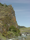 | 549 | Frog Woman Rock | Hwy 101 38°54′45″N 123°03′22″W / 38.9125°N 123.056111°W / 38.9125; -123.056111 (Frog Woman Rock) | Hopland | |
 | 714 | Mendocino Presbyterian Church | 44831 Main St. 39°18′18″N 123°47′48″W / 39.3049°N 123.7967°W / 39.3049; -123.7967 (Mendocino Presbyterian Church) | Mendocino | |
 | 1035 | Point Arena Light | Lighthouse Rd. 38°57′17″N 123°44′26″W / 38.954722°N 123.740556°W / 38.954722; -123.740556 (Point Arena Light) | Point Arena | |
 | 674 | Round Valley | Inspiration Point 39°43′46″N 123°15′07″W / 39.72946°N 123.25198°W / 39.72946; -123.25198 (Round Valley) | Covelo | |
 | 926 | Sun House | 431 S. Main St. 39°08′51″N 123°12′16″W / 39.1475°N 123.204444°W / 39.1475; -123.204444 (Sun House) | Ukiah | |
 | 927 | Temple of Kwan Tai | 45160 Albion St. 39°18′18″N 123°48′11″W / 39.305°N 123.803°W / 39.305; -123.803 (Temple of Kwan Tai) | Mendocino | |
 Upload Photo | 980 | Ukiah Vichy Springs Resort | 2701 Vichy Springs Rd. 39°10′02″N 123°09′32″W / 39.1670917°N 123.1588029°W / 39.1670917; -123.1588029 (Ukiah Vichy Springs Resort) | Ukiah |
References
- ^ "California Historical Landmarks By County". Ohp.parks.ca.gov. Retrieved 2019-04-03.
See also
Wikimedia Commons has media related to California Historical Landmarks in Mendocino County, California.
- List of California Historical Landmarks
- National Register of Historic Places listings in Mendocino County, California
- v
- t
- e
| |||||||||||||||||
National Forests and Grasslands | |||||||
|---|---|---|---|---|---|---|---|
| |||||||
|
| |||||||
| |||||||
|
|
- Heritage registers
- National Natural Landmarks


