National Register of Historic Places listings in Hall County, Georgia
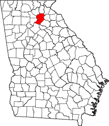
This is a list of properties and districts in Hall County, Georgia that are listed on the National Register of Historic Places (NRHP).
Map all coordinates using OpenStreetMap
Download coordinates as:
- KML
- GPX (all coordinates)
- GPX (primary coordinates)
- GPX (secondary coordinates)
This National Park Service list is complete through NPS recent listings posted June 21, 2024.[1]
- v
- t
- e
Properties on the National Register of Historic Places in Georgia by county
- Appling
- Atkinson
- Bacon
- Baker
- Baldwin
- Banks
- Barrow
- Bartow
- Ben Hill
- Berrien
- Bibb
- Bleckley
- Brantley
- Brooks
- Bryan
- Bulloch
- Burke
- Butts
- Calhoun
- Camden
- Candler
- Carroll
- Catoosa
- Charlton
- Chatham
- Chattahoochee
- Chattooga
- Cherokee
- Clarke
- Clay
- Clayton
- Clinch
- Cobb
- Coffee
- Colquitt
- Columbia
- Cook
- Coweta
- Crawford
- Crisp
- Dade
- Dawson
- Decatur
- DeKalb
- Dodge
- Dooly
- Dougherty
- Douglas
- Early
- Echols
- Effingham
- Elbert
- Emanuel
- Evans
- Fannin
- Fayette
- Floyd
- Forsyth
- Franklin
- Fulton
- Gilmer
- Glascock
- Glynn
- Gordon
- Grady
- Greene
- Gwinnett
- Habersham
- Hall
- Hancock
- Haralson
- Harris
- Hart
- Heard
- Henry
- Houston
- Irwin
- Jackson
- Jasper
- Jeff Davis
- Jefferson
- Jenkins
- Johnson
- Jones
- Lamar
- Lanier
- Laurens
- Lee
- Liberty
- Lincoln
- Long
- Lowndes
- Lumpkin
- Macon
- Madison
- Marion
- McDuffie
- McIntosh
- Meriwether
- Miller
- Mitchell
- Monroe
- Montgomery
- Morgan
- Murray
- Muscogee
- Newton
- Oconee
- Oglethorpe
- Paulding
- Peach
- Pickens
- Pierce
- Pike
- Polk
- Pulaski
- Putnam
- Quitman
- Rabun
- Randolph
- Richmond
- Rockdale
- Schley
- Screven
- Seminole
- Spalding
- Stephens
- Stewart
- Sumter
- Talbot
- Taliaferro
- Tattnall
- Taylor
- Telfair
- Terrell
- Thomas
- Tift
- Toombs
- Towns
- Treutlen
- Troup
- Turner
- Twiggs
- Union
- Upson
- Walker
- Walton
- Ware
- Warren
- Washington
- Wayne
- Webster
- Wheeler
- White
- Whitfield
- Wilcox
- Wilkes
- Wilkinson
- Worth

Current listings
| [2] | Name on the Register | Image | Date listed[3] | Location | City or town | Description |
|---|---|---|---|---|---|---|
| 1 | Alta Vista Cemetery |  | August 28, 2012 (#12000551) | 521 Jones Street 34°17′24″N 83°50′15″W / 34.290091°N 83.837442°W / 34.290091; -83.837442 (Alta Vista Cemetery) | Gainesville | |
| 2 | Bailey-Harper House-Doctors Building |  | June 14, 2006 (#06000504) | 204 Green St., NE 34°18′05″N 83°49′35″W / 34.301389°N 83.826389°W / 34.301389; -83.826389 (Bailey-Harper House-Doctors Building) | Gainesville | |
| 3 | Bowman-Pirkle House |  | August 14, 1973 (#73000623) | NE of Buford off U.S. 23 on Friendship Rd. 34°08′33″N 83°57′16″W / 34.1425°N 83.954444°W / 34.1425; -83.954444 (Bowman-Pirkle House) | Buford | |
| 4 | Brenau College District |  | August 24, 1978 (#78000987) | Academy, Prior, Washington and Boulevard Sts. 34°18′12″N 83°49′19″W / 34.303333°N 83.821944°W / 34.303333; -83.821944 (Brenau College District) | Gainesville | |
| 5 | Candler Street School |  | September 30, 1982 (#82002447) | 525 Candler St. 34°18′28″N 83°49′29″W / 34.3078°N 83.8246°W / 34.3078; -83.8246 (Candler Street School) | Gainesville | |
| 6 | Chicopee Mill and Village Historic District |  | July 25, 1985 (#85001638) | Roughly bounded by Fourth & Fifth Sts., North, K, 8th, H, G & F Aves. on US 23 34°15′11″N 83°50′45″W / 34.253056°N 83.845833°W / 34.253056; -83.845833 (Chicopee Mill and Village Historic District) | Gainesville | |
| 7 | Clermont Residential Historic District | Upload image | September 5, 1985 (#85001970) | Main, Harris, Martin, and Railroad Sts. 34°28′46″N 83°46′24″W / 34.479444°N 83.773333°W / 34.479444; -83.773333 (Clermont Residential Historic District) | Clermont | |
| 8 | Dixie Hunt Hotel |  | May 16, 1985 (#85001057) | 209 Spring St., SW 34°17′54″N 83°49′38″W / 34.298333°N 83.827222°W / 34.298333; -83.827222 (Dixie Hunt Hotel) | Gainesville | |
| 9 | Federal Building and Courthouse |  | January 24, 1974 (#74000684) | 126 Washington St. 34°17′59″N 83°49′34″W / 34.299722°N 83.826111°W / 34.299722; -83.826111 (Federal Building and Courthouse) | Gainesville | |
| 10 | Flowery Branch Commercial Historic District | Upload image | August 30, 1985 (#85001932) | Main St. & Railroad Ave. 34°11′05″N 83°55′31″W / 34.184722°N 83.925278°W / 34.184722; -83.925278 (Flowery Branch Commercial Historic District) | Flowery Branch | |
| 11 | Friendship Baptist Church Cemetery |  | August 20, 2019 (#100004298) | 3759 Friendship Rd. 34°07′33″N 83°55′12″W / 34.1258°N 83.9200°W / 34.1258; -83.9200 (Friendship Baptist Church Cemetery) | Buford | |
| 12 | Gainesville Commercial Historic District |  | March 14, 2003 (#02000873) | Roughly bounded by Broad St., Maple St., Academy St. and Green St. 34°17′57″N 83°49′37″W / 34.299167°N 83.826944°W / 34.299167; -83.826944 (Gainesville Commercial Historic District) | Gainesville | |
| 13 | Gillsville Historic District |  | August 30, 1985 (#85001933) | GA 52 34°18′38″N 83°38′20″W / 34.310556°N 83.638889°W / 34.310556; -83.638889 (Gillsville Historic District) | Gillsville | |
| 14 | Green Street District |  | August 15, 1975 (#75000596) | Both sides of Green St. from Green Street Pl. to Glenwood Rd. 34°18′27″N 83°49′37″W / 34.3075°N 83.826944°W / 34.3075; -83.826944 (Green Street District) | Gainesville | |
| 15 | Green Street-Brenau Historic District |  | September 5, 1985 (#85001974) | Green, Candler, Park, Brenau, Boulevard & Prior Sts., Green St. Circle, City Park and much of Brenau College Campus 34°18′29″N 83°49′31″W / 34.308056°N 83.825278°W / 34.308056; -83.825278 (Green Street-Brenau Historic District) | Gainesville | |
| 16 | Hall County Courthouse |  | June 8, 1995 (#95000717) | Jct. of Spring and Green Sts. 34°17′56″N 83°49′32″W / 34.298889°N 83.825556°W / 34.298889; -83.825556 (Hall County Courthouse) | Gainesville | |
| 17 | Hall County Jail | Upload image | September 13, 1985 (#85002084) | Bradford St. 34°17′52″N 83°49′33″W / 34.297778°N 83.825833°W / 34.297778; -83.825833 (Hall County Jail) | Gainesville | |
| 18 | Head's Mill |  | January 12, 1990 (#89002301) | Whitehall Rd., E of jct. with US 23 34°22′27″N 83°43′55″W / 34.374167°N 83.731944°W / 34.374167; -83.731944 (Head's Mill) | Lula | |
| 19 | Jackson Building | 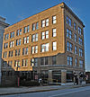 | August 1, 1985 (#85001677) | 112 Washington St. NE 34°17′58″N 83°49′35″W / 34.299444°N 83.826389°W / 34.299444; -83.826389 (Jackson Building) | Gainesville | |
| 20 | Logan Building |  | January 4, 1990 (#89002266) | 119 E. Washington St. 34°18′00″N 83°49′34″W / 34.3°N 83.826111°W / 34.3; -83.826111 (Logan Building) | Gainesville | |
| 21 | Lula Residential Historic District |  | September 11, 1985 (#85002244) | Cobb, Carter, Chattahoochee and Toombs Sts. 34°23′17″N 83°40′11″W / 34.388071°N 83.669819°W / 34.388071; -83.669819 (Lula Residential Historic District) | Lula | |
| 22 | Beulah Rucker House-School |  | May 4, 1995 (#95000533) | 2110 Athens Hwy. 34°16′54″N 83°47′16″W / 34.281667°N 83.787778°W / 34.281667; -83.787778 (Beulah Rucker House-School) | Gainesville | |
| 23 | Tanner's Mill | Upload image | September 10, 1979 (#79000729) | S of Gainesville on SR 3 34°10′42″N 83°47′13″W / 34.178333°N 83.786944°W / 34.178333; -83.786944 (Tanner's Mill) | Gainesville |
References
- ^ National Park Service, United States Department of the Interior, "National Register of Historic Places: Weekly List Actions", retrieved June 21, 2024.
- ^ Numbers represent an alphabetical ordering by significant words. Various colorings, defined here, differentiate National Historic Landmarks and historic districts from other NRHP buildings, structures, sites or objects.
- ^ The eight-digit number below each date is the number assigned to each location in the National Register Information System database, which can be viewed by clicking the number.
Wikimedia Commons has media related to National Register of Historic Places in Hall County, Georgia.
| |
|---|---|
| Topics | |
| Lists by state |
|
| Lists by insular areas | |
| Lists by associated state | |
| Other areas | |
| Related | |
| |


